David 'Dippie' Dixon introduces the area thus in his renowned book Upper Coquetdale, first published in 1903. The valley today is still a place "rife with historic associations". Dixon adds: "Throughout the length and breadth of this charming bit of Northumberland, whether it be amid the wide expanse of its heathery moorlands or the grandeur of its lofty hills, in it rocky ravines and wooded dells, the lover of nature will find an ample field of enjoyment and research."
I visit Upper Coquetdale regularly, grateful that it is, so to speak, just on my doorstep. My knowledge of its wildlife seems to grow with every visit.
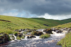
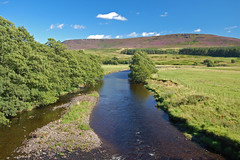
The river Coquet, seen here in spate beside Kateshaw Crag,
eight miles from its source near the Scottish border.
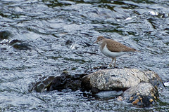
A Common Sandpiper (Actitis hypoleucos) seen on the river
in spring and summer.
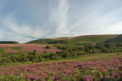
Heather moorland beside the Holystone Burn
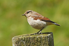
A juvenille Wheatear (Oeanthe oeanthe)
The river flows lazily at Hepple Bridge
No comments:
Post a Comment